Aerial Drone Content
Aerial Drone Content
Aerial Drone Photography & Video on Long Island
Show buyers what makes the property and its Long Island location stand apart.
Frame & Focus Studio captures waterfront, land, surroundings, and outdoor features from above. Professional aerial media gives buyers a view that ground-level images cannot provide.
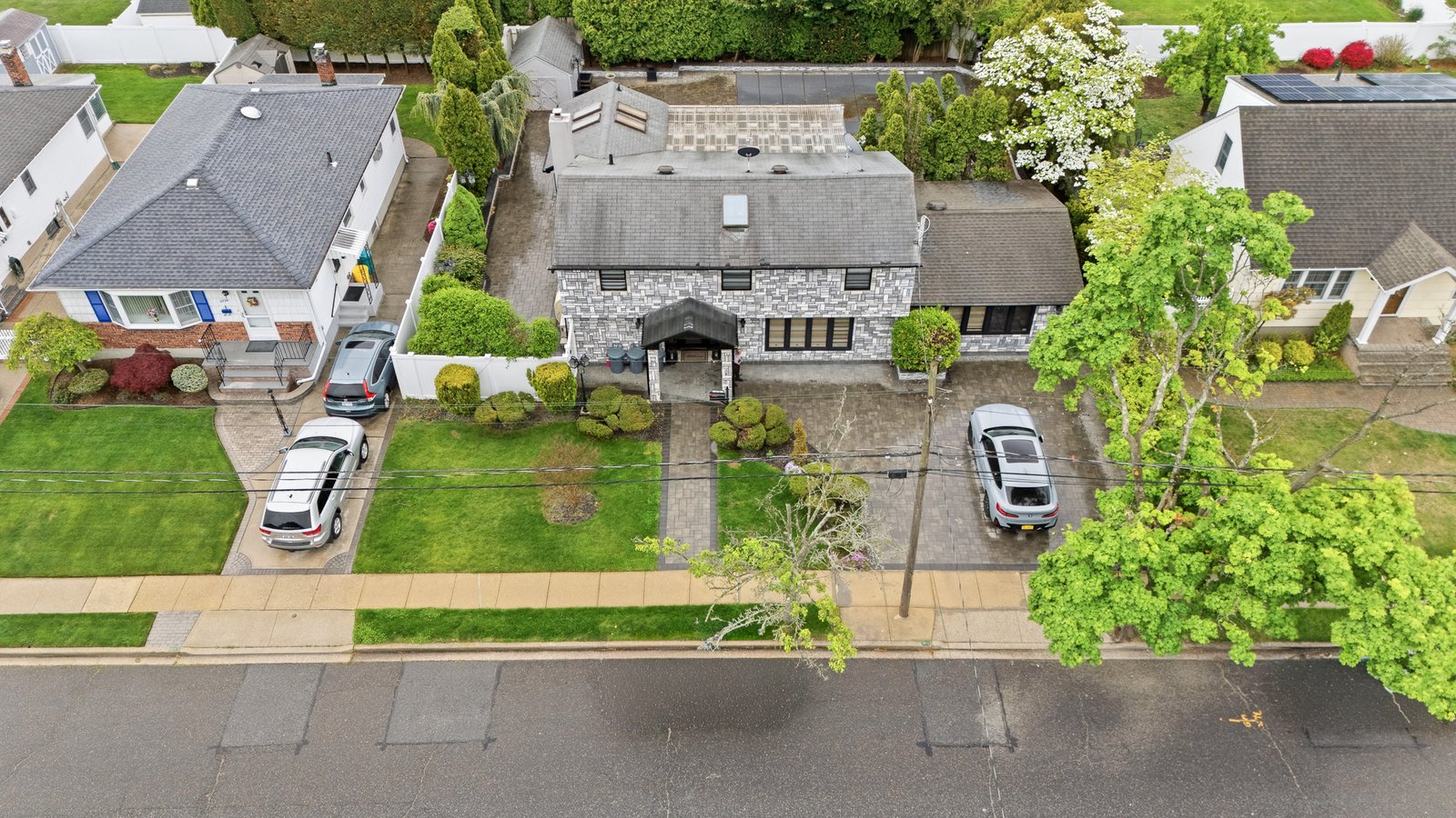
Show the Complete Property From Above
Ground photographs reveal rooms, finishes, and exterior details. However, they cannot always show the full property setting.
Aerial photography captures the home, lot, driveway, yard, shoreline, and nearby features together. Buyers can quickly understand how the property sits within its surroundings.
Top-down images also show outdoor layouts with greater clarity. Pools, gardens, docks, patios, and separate buildings become easier to view.
Aerial video adds smooth movement across the property. It can begin above the neighborhood, approach the home, and reveal key exterior features.
Together, these views create a stronger sense of place.
Who Should Book Aerial Listing Photos?
Drone media works best when location, land, or outdoor features support the listing story.
Waterfront Property Listings
Long Island waterfront homes often have features hidden from street-level photographs. Aerial views can show shoreline access, docks, canals, beaches, and nearby water. They also help buyers understand the home’s position along the coast.
Homes With Large Lots or Acreage
Wide properties can feel difficult to explain through standard exterior images. Drone photos for large lots show open space, long driveways, wooded areas, and separate structures. They can also present the scale more clearly.
Properties in Unique Locations
Some homes gain value from nearby parks, marinas, town centers, or coastal areas. A higher viewpoint can connect the property with those nearby features. However, images should never suggest inaccurate distances or access.
New Construction and Development Projects
Aerial coverage can document building progress and show the full development site. Builders may also use updated photographs for sales materials, project reports, and future marketing.
When Drone Coverage Adds Less Value
Aerial media may add less impact on tiny lots or tightly packed blocks. In those cases, strong interior and exterior photography may tell the property story better. James can discuss the listing before recommending aerial coverage.
Why Real Estate Drone Photography Matters
Buyers often want more than a front exterior and several room photographs.
They may also want to understand the lot, street, nearby homes, and outdoor layout. Aerial media answers many of those questions through one clear viewpoint.
The National Association of Realtors reported that 52% of surveyed agents used drone photography or video in 2025. This figure shows growing use across property marketing, though results differ between listings.
Drone images may help a suitable listing attract more attention online. Still, no media service can promise a quicker sale or a higher offer.
The strongest results come when aerial images support a clear property feature. Waterfront access, acreage, views, and outdoor spaces are good examples
What Your Aerial Photography Service Includes
1. Schedule Your Session
Book a convenient date and confirm flight conditions.
2. Flight Planning
We assess the location and plan the best flight path for maximum coverage.
3. Drone Capture
Our licensed operator captures high-quality aerial photos and videos.
4. Professional Editing
Every video is professionally edited with music, transitions, and cinematic color grading.
5. Final Delivery
Receive ready-to-use files for listings, marketing, and social media.
Elevate Your Property Marketing
Show your property from a whole new perspective with professional aerial drone photography and videography.